
Axamit Gate, Jelínek Bridge, Kotýz – Bohemian Karst
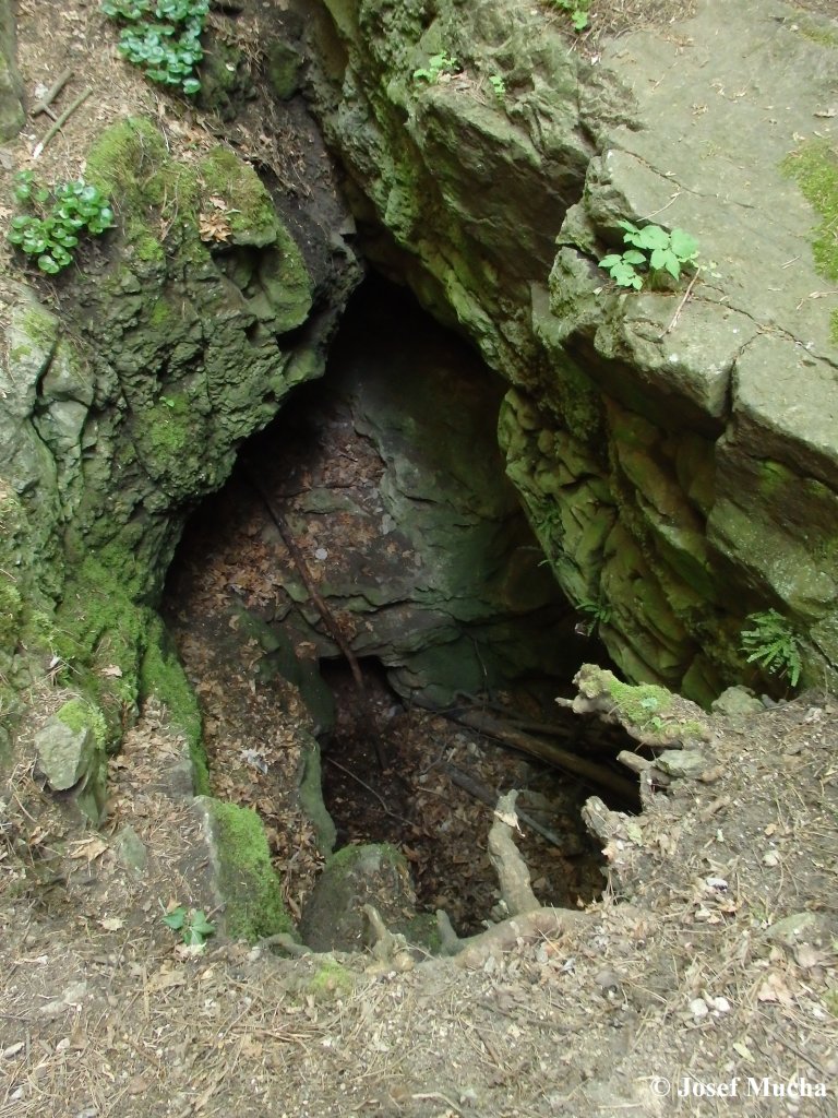
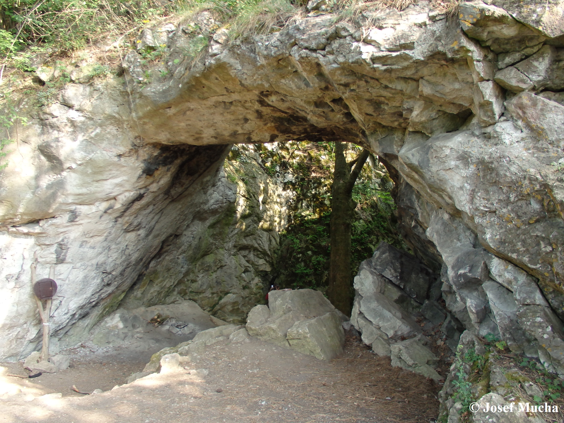
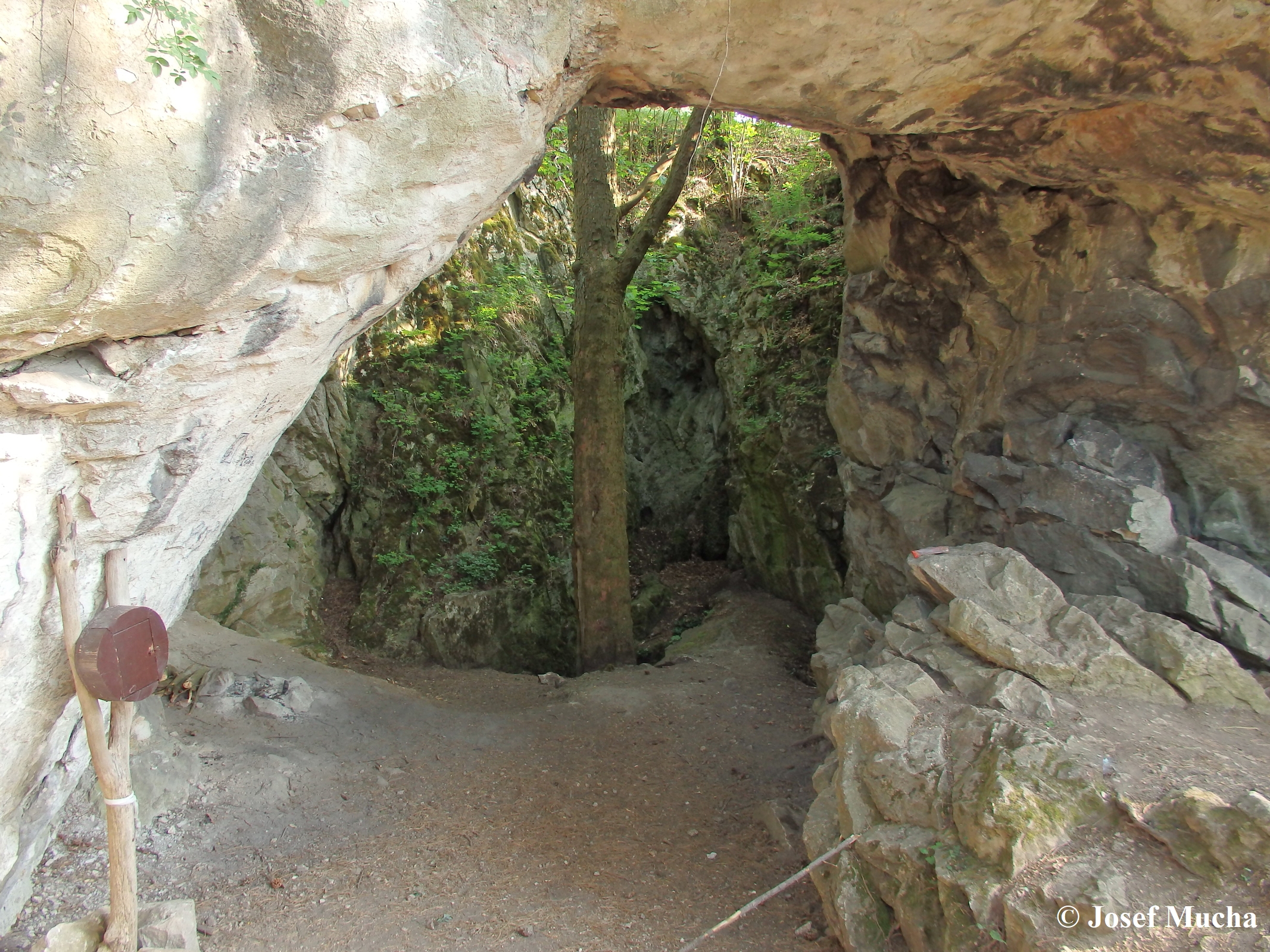
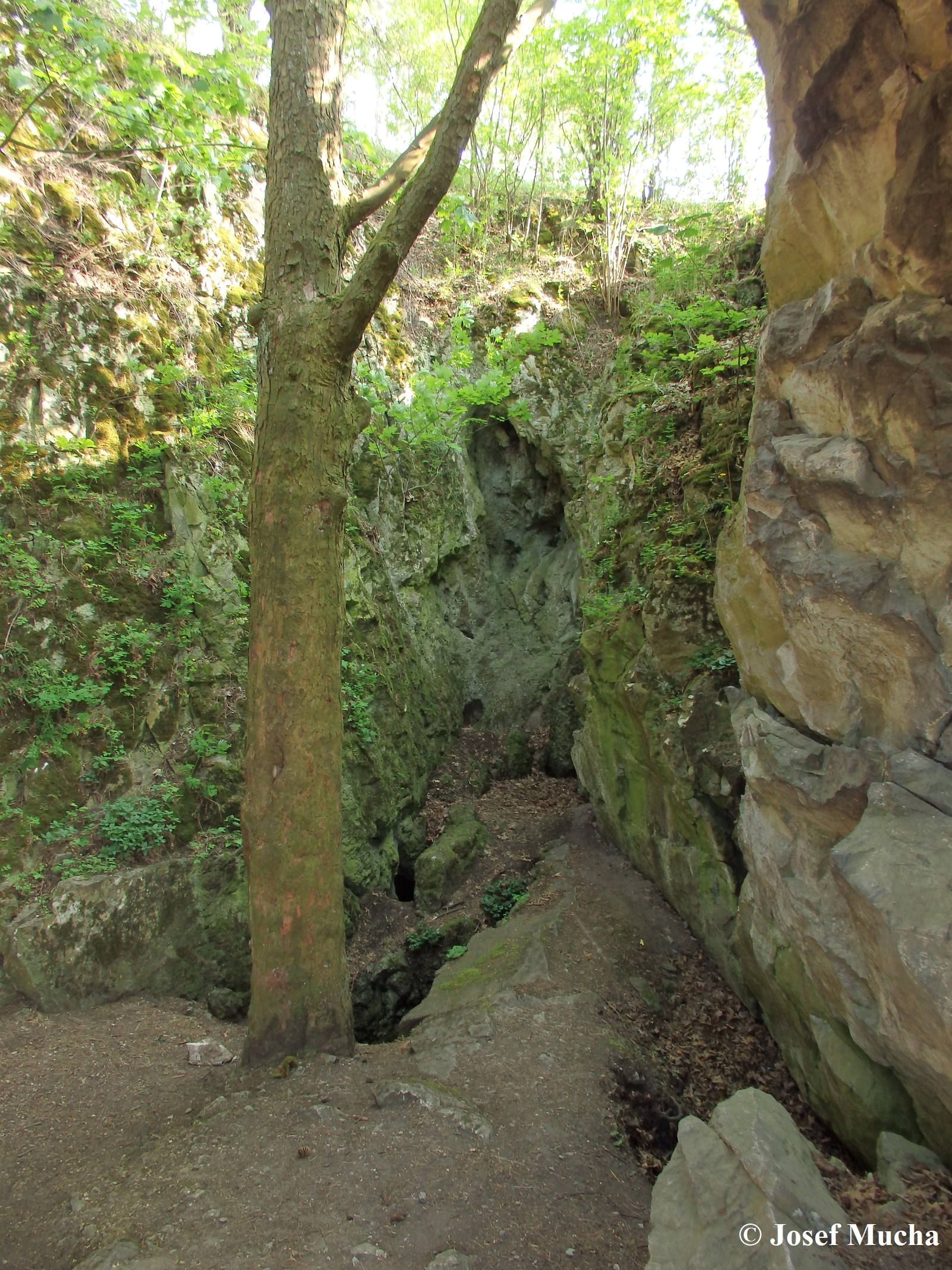
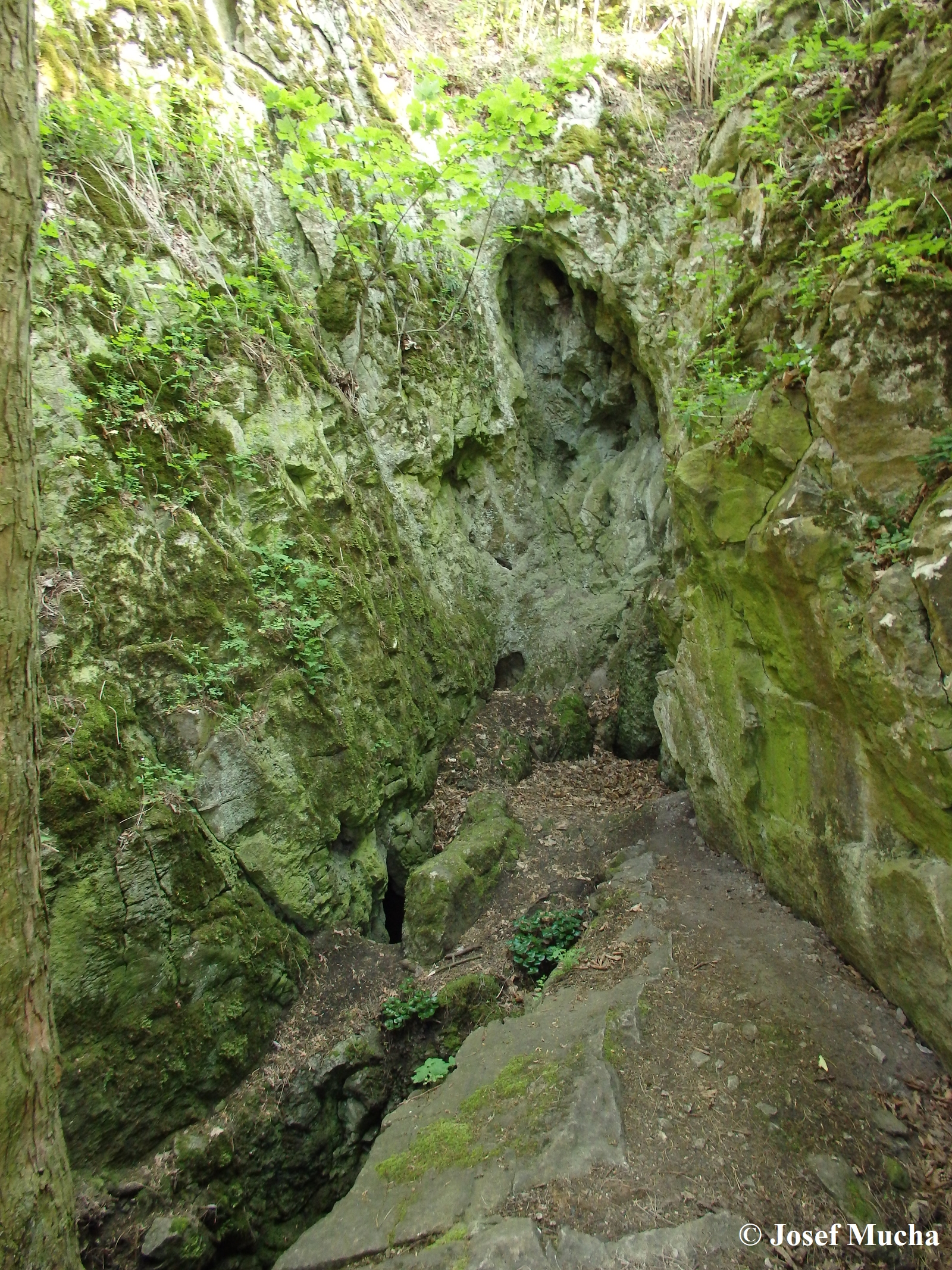
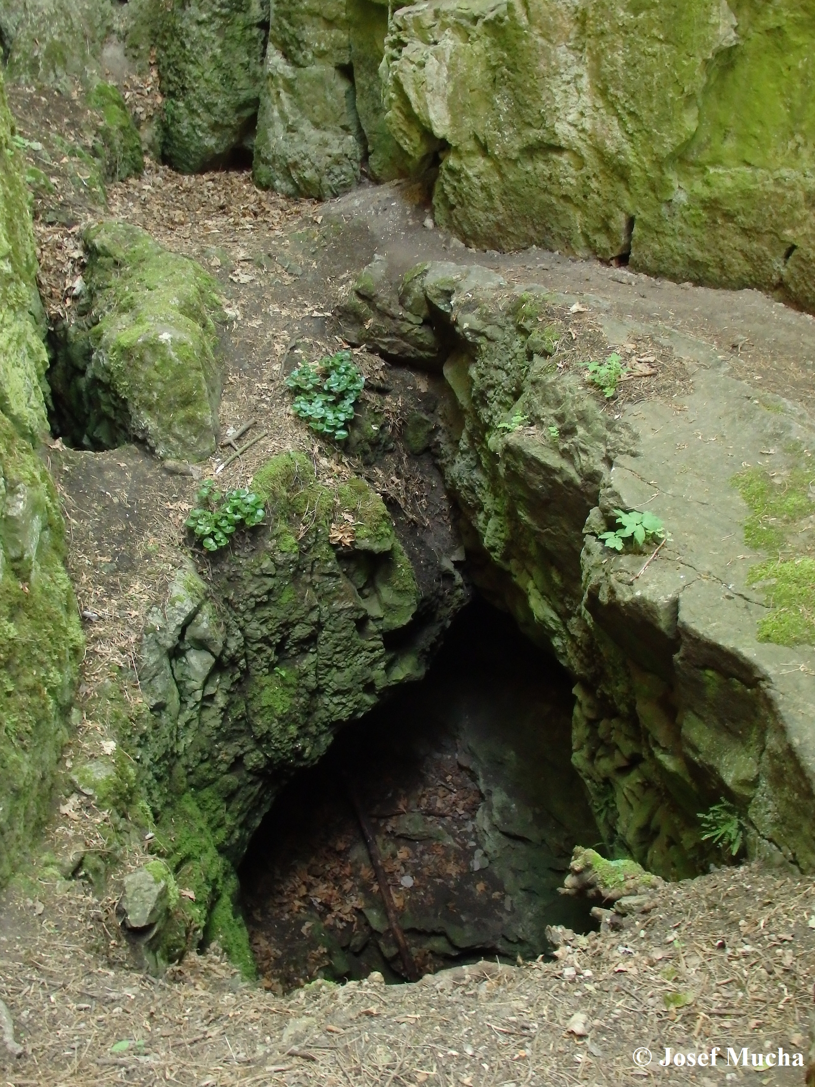
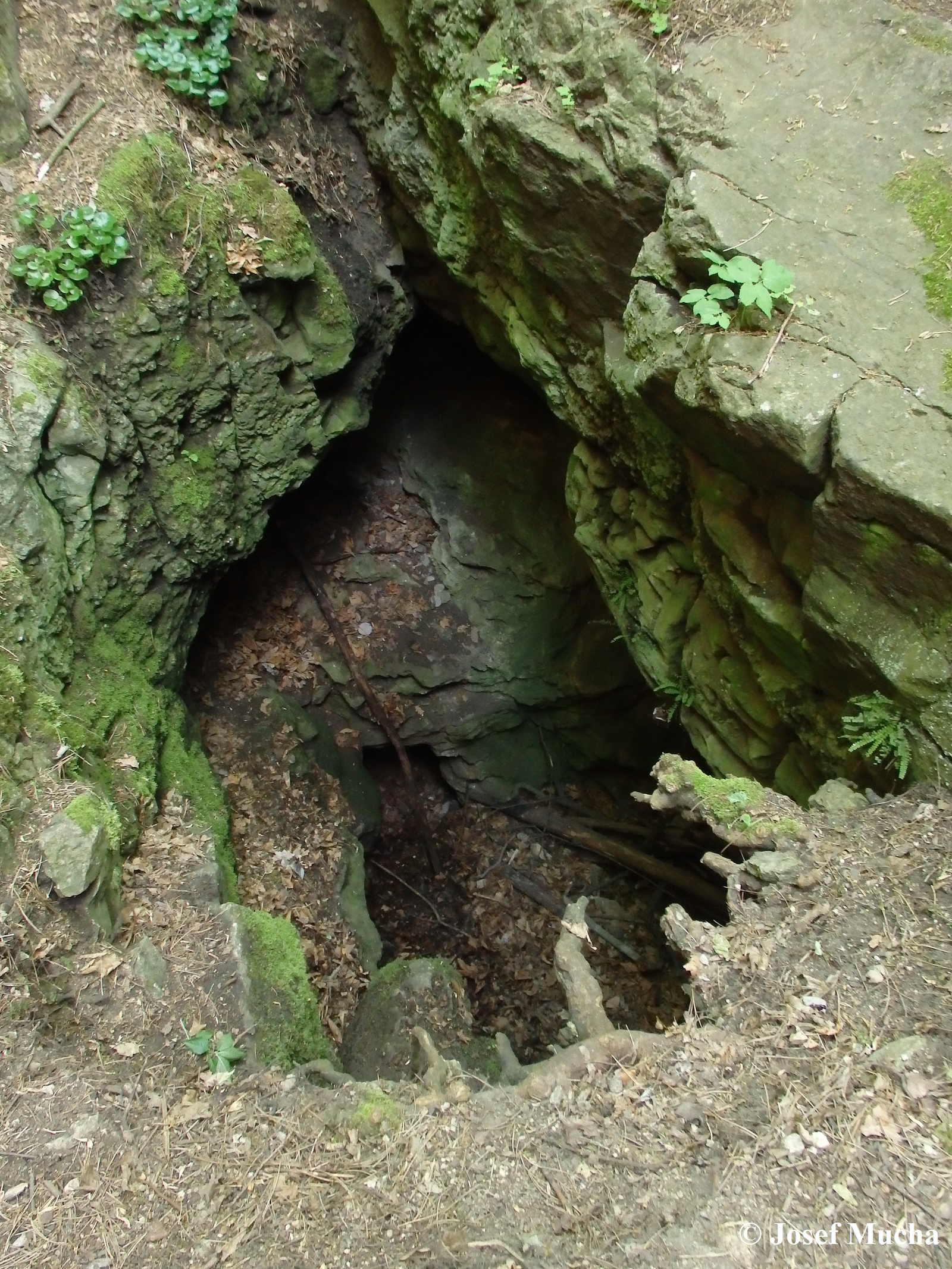
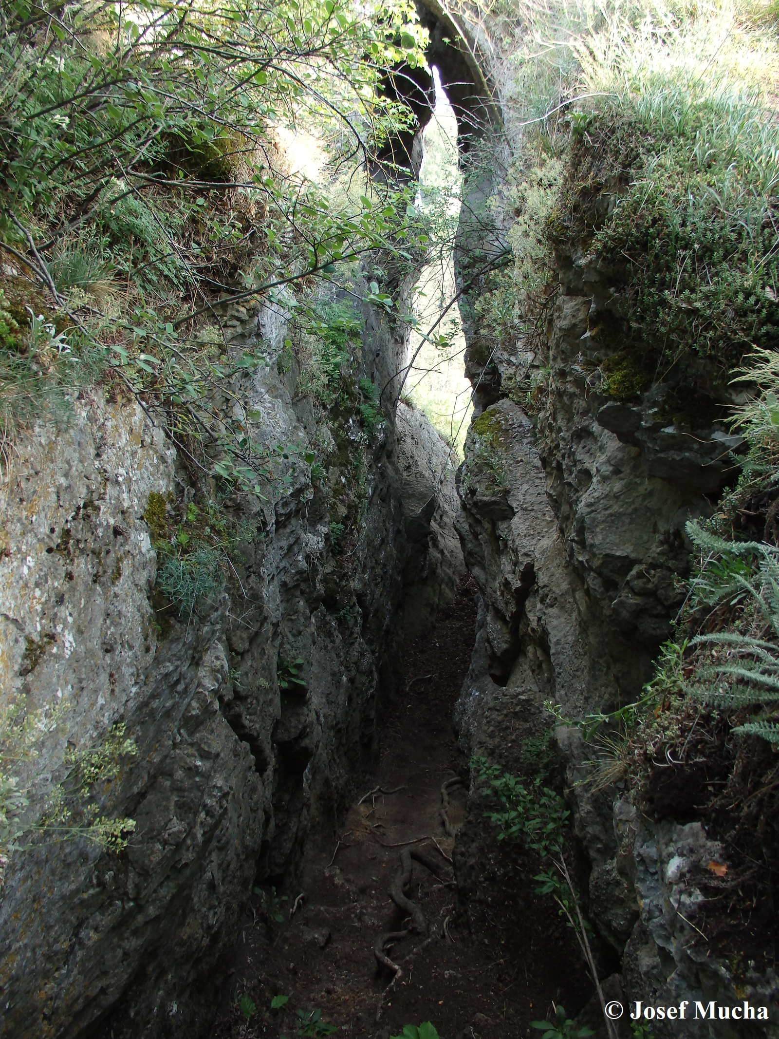
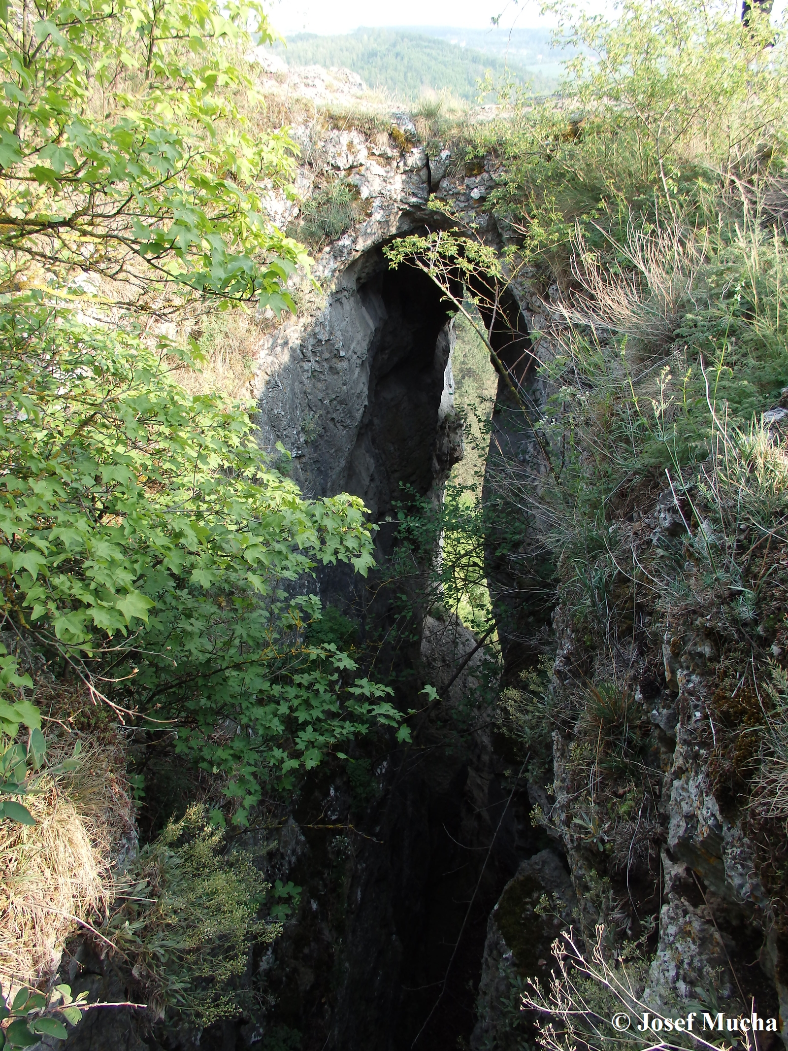
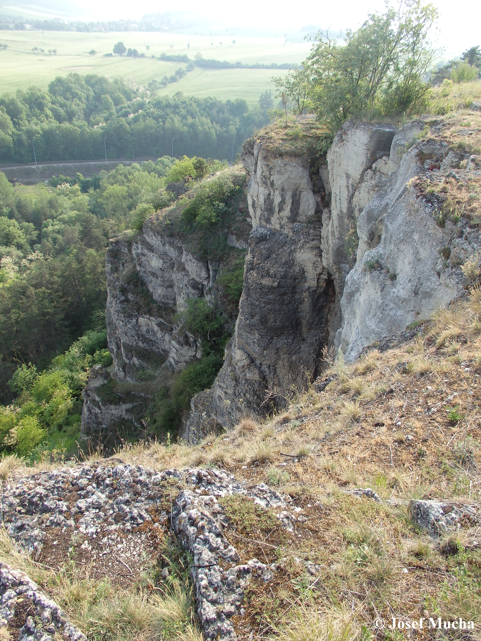
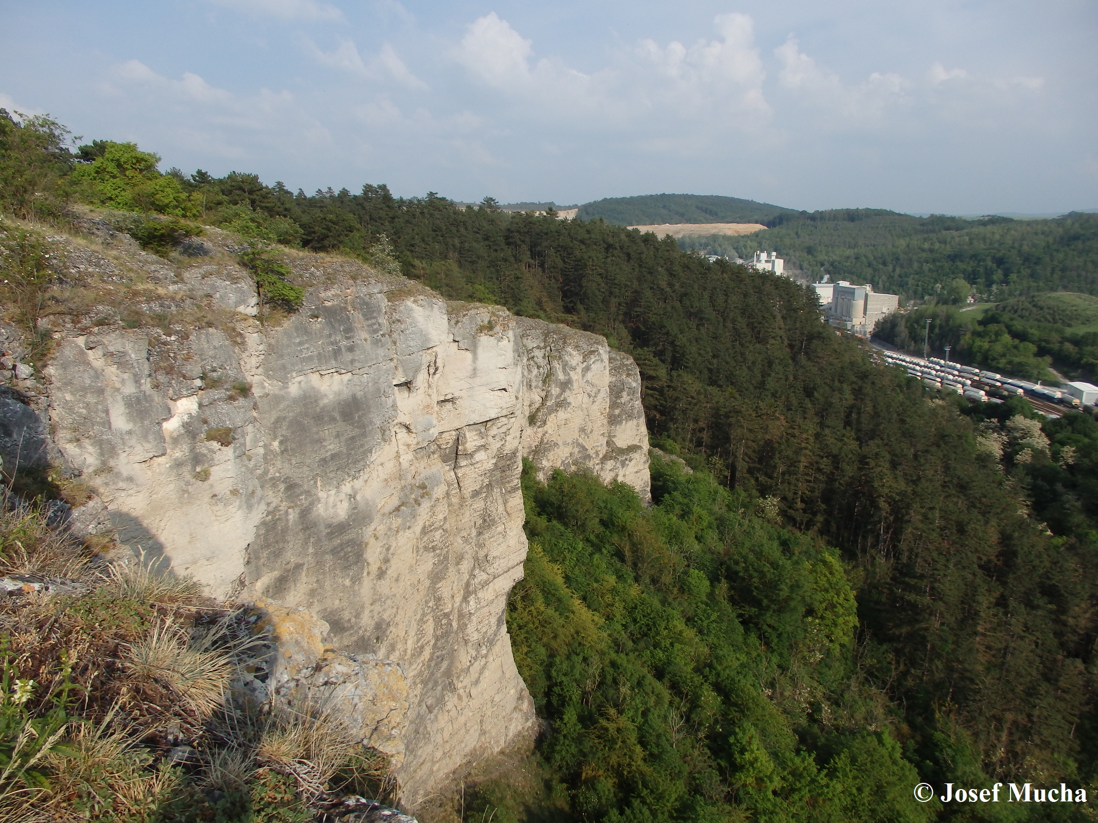
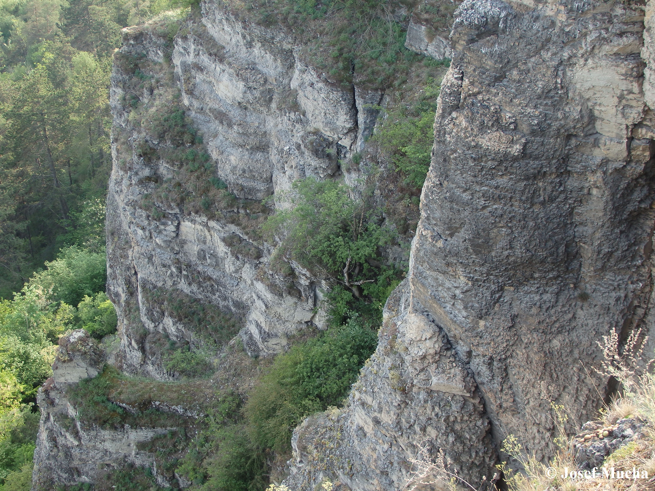
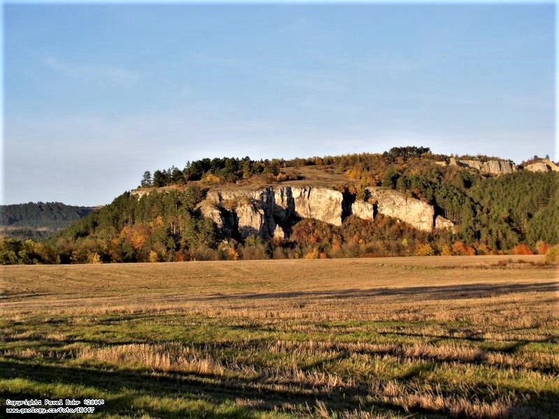
On the vast rocky hill of Kotýz (part of the Zlatý kůň massif), above the valley of the Suchomastský stream, there is the largest natural gate of the Bohemian Karst – the Axamit Gate. The entire Kotýz massif is built of very pure Lower Devonian limestones (Lochkov stage – age approx. 410 million years), which sedimented on a coral reef. At that time, the reef was located in the subtropical belt in the southern hemisphere of the Earth and was inhabited by more than 500 species of animals in the then warm sea in Barrandien. The total period of sedimentation of the Zlatý kůň rock massif from organodetritic limestones lasted more than 20 million years. The beautiful and steep walls of Kotýz have a typical karst structure with rock overhangs (so-called elephant heads), caves (Děravá jeskyně) and rock bridges . The entrance to the former karst cave is the rocky Axamitova brána, the ceiling of which may have collapsed in the past. Some experts are inclined to believe that it is more of a karst-widened fissure, which is created in a powerful vein of coarsely crystalline pure calcite. It is therefore probably a karst-forming hydrothermal corrosion cavity. From the original form of the fissure, only the rocky gate measuring 6 x 4.5 x 2.5 meters has been preserved. An open space with perpendicular walls without a ceiling measuring approximately 10 x 13 meters was created here. At the bottom of the Axamitova brána is the abyss-like cave Ve Vratech, 16 meters long. Several archaeological excavations were carried out in the cave between 1834 and 1986. The limestone rock bridge was named after Dr. Jan Axamit (an ENT doctor and archaeologist), who participated in the research of these caves in the Bohemian Karst in the 1920s. A similar karst feature is the double rock bridge (Jelínkův most), spanning a 9-meter deep and approximately 1-meter wide rock crevice, which probably formed on a calcite vein also by karstification. Below the rocky edge of Kotýz is the Déravá jeskyné, once inhabited by Paleolithic hunters. Unique engravings of prehistoric animals on slate slabs were found in the cave.
All rock crevices and caves on Kotýz are important archaeological sites.
Zeměpisná šířka
49° 55' 1.56" N
Zeměpisná délka
14° 2' 53.16" E